Know which sites have moved into your stage before you pick up the phone.
Plant On Site reads the cranes, excavators and stacked material on a construction site from satellite and aerial imagery, and tells you whether it is in groundworks, structure or fit-out.
- GSD
- VHR ≤0.5 m
- Cadence
- roughly every two weeks
- Platform
- VHR satellite / aerial
- Spectral
- RGB
Every site on the list gets the same call on the same day
You cover a patch and you hold a list of live sites. The lead service told you each one exists and when it was meant to start. It did not tell you what is standing on it this fortnight. So the round goes out the same way it always does: every address, top to bottom.
Some of those calls land well. Plenty do not. You ring a site manager about second-fix ironmongery and the site is still a hole with a dumper in it. He has nothing to say to you yet. The site next door had its frame go up while you were working through the list in order, the cladding and insulation were called off by the contractor's buyer, and the order went to whoever happened to ring in the week it mattered.
You only find out afterwards, when the delivery lorry from a competitor's yard is at the gate. Nobody sends you a note that the site has moved on. The only way to see it is to drive past, and with a patch this size you cannot drive past all of them.
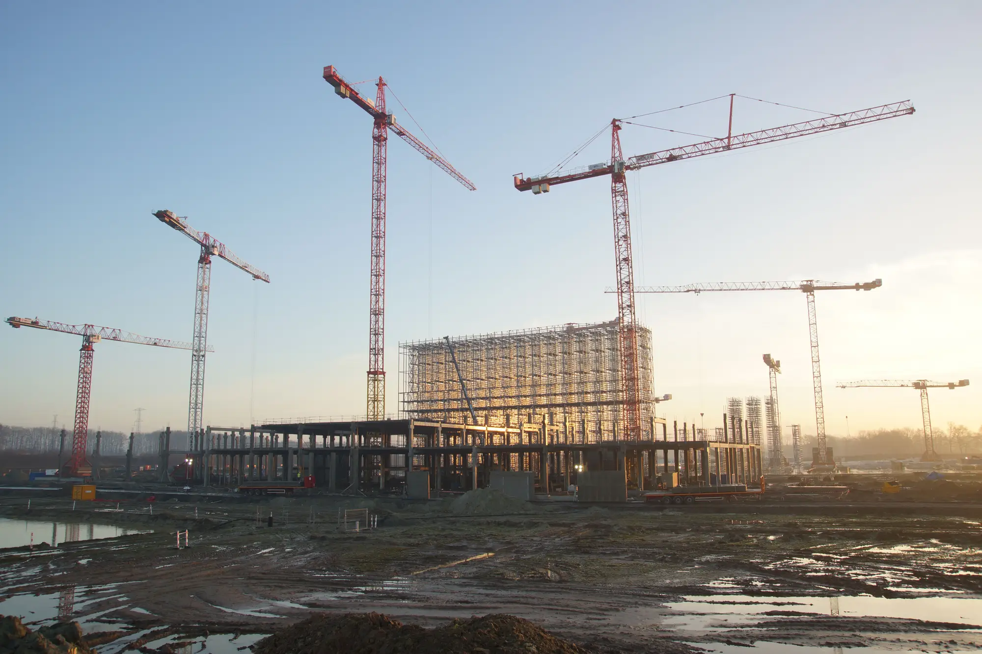
Plant On Site changes the order of the round. Each pass over your addresses tells you which sites are in which stage and which ones changed since the last look, so you spend the week on the sites that have just reached the phase your product gets specified for.
What comes back for your address list
Nothing here is a finished product yet. The pilot is a chance to shape the format with us, and the first version is a plain list.
2.1
Stage read per site
Groundworks, structure or fit-out
One stage for each address on your list, on each pass. It comes from what is visible on the ground: plant, stacked material, the state of the footprint. It lands in a spreadsheet you can drop into your CRM as a stage tag.
2.2
Watchlist
Your address list
Your addresses stay on a standing list, so every new pass covers the same sites without you resending anything. Add or remove addresses as your patch changes.
2.3
Change flag
Changed since last pass
A marker on any site whose stage differs from the previous read. This is the column to sort by on Monday morning.
How it works
Send the addresses
You send the site list, with a postcode or address for each. A project reference is useful if you have one.
We pull the next clear pass
We take the next available very high resolution satellite or aerial image over each site. If cloud covers a site, that pass is skipped for it and the last clear read stands.
The model reads the site
Cranes, excavators, stacked material and the state of the building footprint are classified against the three stages.
You get the stage and the flag
A stage label and a change flag for each address, about every two weeks.
Where it fits in your work
Plant On Site sits ahead of your CRM, not inside it. The stage tag is an extra column beside what the lead service already gives you, and your reps use it to sequence the round instead of running the same route each month. The lead feed tells you a project exists. This tells you where it has got to.
Limits
Limit 1
About every two weeks, imagery permitting
That is the target cadence, and it depends on a clear pass. It is not daily and it is not live. A site under cloud keeps its previous stage until a clear read replaces it.
Limit 2
A stage label, not a schedule
The output says where the site is now. It does not predict when the next stage starts or when the job finishes, and it says nothing about contract values or which products are specified.
Limit 3
What a pixel can see
At 0.5 m or finer, large plant and stacked material are the things to look for. Small items do not: a pallet, a single skip or a hand tool will not be picked out.
Limit 4
Fit-out is the hardest call
Once the building is closed in, the work moves inside and imagery sees only the outside. The fit-out read rests on the shell being complete and on signs like the plant leaving and scaffolding coming down. Expect fewer certain reads at this end.
Limit 5
Commercial and industrial sites with visible plant
Residential builds and sites heavily covered by roofing, hoardings or trees are out of scope. If nothing is visible from above, there is nothing to read.
Who it's for
For
- Regional and area sales reps at building-materials suppliers who time calls to the stage a site is at.
- Hire desk and sales teams at equipment-rental firms who need to know when plant is going onto a site or coming off.
- Sales managers who own a target list of commercial and industrial sites and want the round sequenced.
Not for
- Teams that want a completion date or programme forecast.
- Teams looking for residential new-build tracking.
- Buyers who want product specs, contract values or the contractor's buying decisions read from a picture.
- Teams that need daily or live updates.
Questions from sales managers
Does this work on residential builds?
No. It is for commercial and industrial sites where plant and material can be seen from above.
How often is it updated?
Roughly every two weeks, when there is a clear pass. That is the pilot cadence, and it is a target.
What if it is cloudy over a site?
That pass is skipped for the site and its stage carries over from the last clear read.
Do you give completion dates?
No. You get a stage label and a flag that it changed. It is a picture of where the site is now.
Can we have daily updates?
Not in the pilot. The cadence is set by how often a clear image can be had.
How do we check it against what we see on our own site visits?
Your reps already know a handful of sites well. Send those addresses first and compare the stage we give with what they saw on their last visit. That is a quick way to judge whether the read is useful for your patch.
How does it work with our CRM?
It comes back as a list with one row per address, so you can load the stage and the flag as fields. Direct integrations are not part of the pilot.
Who owns the output, and what about the imagery?
Terms for what you receive are agreed in writing before the pilot starts. The satellite and aerial imagery itself stays under its providers' licences.
What does it cost?
Pricing is agreed per pilot, once we know what you need. Someone from the team will scope it with you.
Bring your address list.
Tell us the patch and the stage you sell into, and we will tell you if the pilot fits.
Join the pilot list